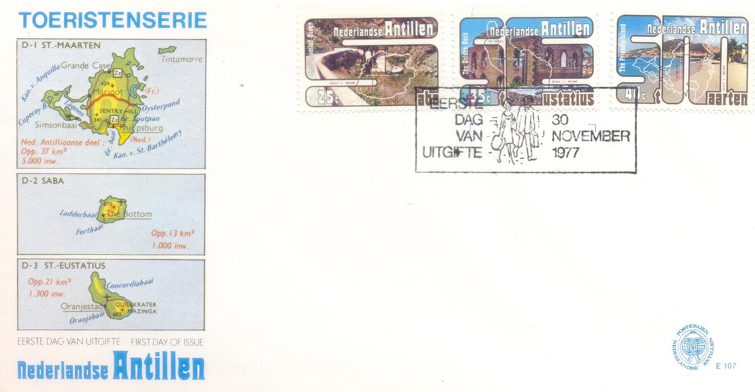
This lovely FDC with the three lovely stamps with a very apt postmark and a very descriptive cover was given to me by my friend Maria. It was issued by the Netherlands Antilles post on 30th November 1977 to encourage Tourism in these Dutch Islands. A brief description about the islands on the cover would not be out of place.
Saint Martin (French: Saint-Martin;
On January 1, 2009 the population of the entire island was 77,741 inhabitants, with 40,917 living on the Dutch side, and 36,824 on the French side.
Collectively, the two territories are known as "St-Martin / St Maarten". Sometimes SXM, the IATA identifier for Princess Juliana International Airport(the island's main airport), is used to refer to the island.
Saba is a Caribbean island and the smallest special municipality (officially publi
Saba, including the islet of Green Island, became a special municipality within the country of the Netherlands after the dissolution of the Netherlands Antilles on 10 October 2010.
The island has a land area of 13 square kilometres (5.0 sq mi). As of January 2013, the population was 1,991 inhabitants, with a population density of 150 inhabitants per square kilometre (390 /sq mi). Its current towns and major settlements are The Bottom (the capital), Windwardside, Hell's Gate and St. Johns.
Sint Eustatius, also known affectionately to the locals as Statia or Statius, is a Caribbean island and a special municipality of the Netherlands.
It lies in the northern Leeward Islands portion of the West Indies, southeast of the Virgin Islands and immediately to the northwest of Saint Kitts and Nevis and to the southeast of Saba. The island is named after the legendary Christian martyr Saint Eustace. The regional capital is Oranjestad.
The island has an area of 21 km² (8.1 sq. miles). In the 2001 census, the population was recorded as 3,543 inhabitants, equating to a population density of 169 inhabitants per square kilometre. The official languages are Dutch and English. A local English-based creole is also spoken informally. Travel to the island by air is through F.D. Roosevelt Airport.
Formerly part of the Netherlands Antilles, Sint Eustatius became a special municipality within the country of the Netherlands on 10 October 2010.
The name of the island "Sint Eustatius" is a reference to Saint Eustace (also spelled Eustachius or Eustathius), a legendary Christian martyr known in Spanish as San Eustaquio and in Portuguese as Santo Eustáquio or Santo Eustácio. This Island was also popularly called “The Golden Rock”.
No comments:
Post a Comment